Class 6 Geography Chapter 4 Notes:- Maps Class 6 Notes
In this post, we provide Class 6 Geography Chapter 4 Notes. In CBSE Class 6 Geography Chapter 4: Maps we will learn about Maps, types of maps, components of maps, etc. Geography class 6 chapter 4 notes are designed by our experienced teachers.
In class 6 Geography chapter 2 notes we have learned about the globe in that chapter we will learn the advantages of a globe but the globe has limitations globe is useful when we want to study the earth as a whole but when we want to study only a part of the earth or a specific country or state or town or village we need a map. Students can also download class 6 geography chapter 4 notes pdf.
In this chapter, we will study maps Class 6 Notes if you want to check class 6th geography notes of other chapters check here.
Maps
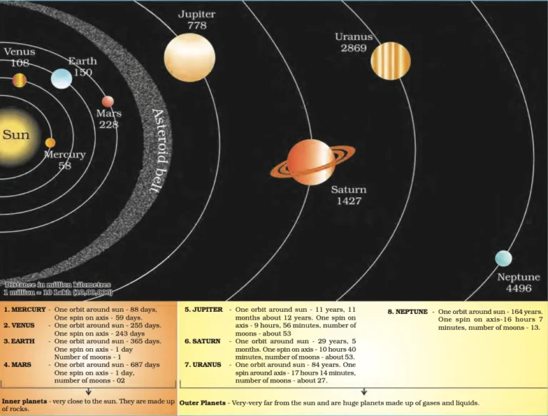
A map is a representation or a drawing of the earth’s surface or a part of it drawn on a flat surface according to a scale. The map can be used for various purposes. There are many types of map, some are shown small areas and a few facts and others are shown many facts as a big book. When we combine many maps together we get an atlas. Atlases are of various sizes, measurements drawn on different scales.
Types of Maps
- PHYSICAL MAPS
Maps showing natural features of the earth such as mountains, plateaus, plains, rivers, oceans etc. are called physical or relief maps. - POLITICAL MAPS
Maps showing cities, towns and villages, and different countries and states with their boundaries are called political maps. - THEMATIC MAPS
Some maps focus on specific information; such as road maps, rainfall maps, maps showing the distribution of forests, industries etc. are known as thematic maps.
Components of Maps
There are three Components of Maps –distance, direction, and symbol.
Distance
Maps are drawings. Which reduces the entire world or a part of it to fit on a sheet of paper. This is possible when a small distance on paper presents a large distance on the ground. For this purpose, a scale is used.
Scale is the ratio between the actual distance on the ground and the distance on the map.
Small scale map
When a large area like a continent or country is to be shown on paper then we use a small scale. For example, 5 cm on the maps shows km. Of the ground. It is called a small-scale map.
Large scale map
When a small area like your village or town is to be shown on paper, then we use a large scale that is 5cm. on the map shows 500m only on the ground. It is called a large-scale map.
Direction
There are four major directions, North, South, East, and West They are called cardinal points. The other four intermediate directions are north-east (NE), south-east (SE), south-west (SW), and north-west (NW). We can locate any place more accurately with the help of these intermediate directions.
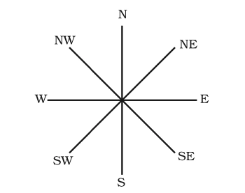
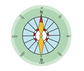
Most maps contain an arrow marked with the letter ‘N’ at the upper right-hand corner. This arrow shows the north direction. It is called the north line. When you know the north, you can find out other directions, for example east, west and south. We can find out the direction of a place with the help of a compass. It is an instrument used to find out the main directions. Its magnetic needle always points towards the north-south direction
Symbol
It is the third important component of a map. It is not possible to draw on a map the actual shape and size of different features such as buildings, roads, bridges, trees, railway lines, or a well. So, they are shown by using certain letters, shades, colours, pictures, and lines These symbols give a lot of information in a limited space. There is an international agreement regarding the use of these symbols. These are called conventional symbols.
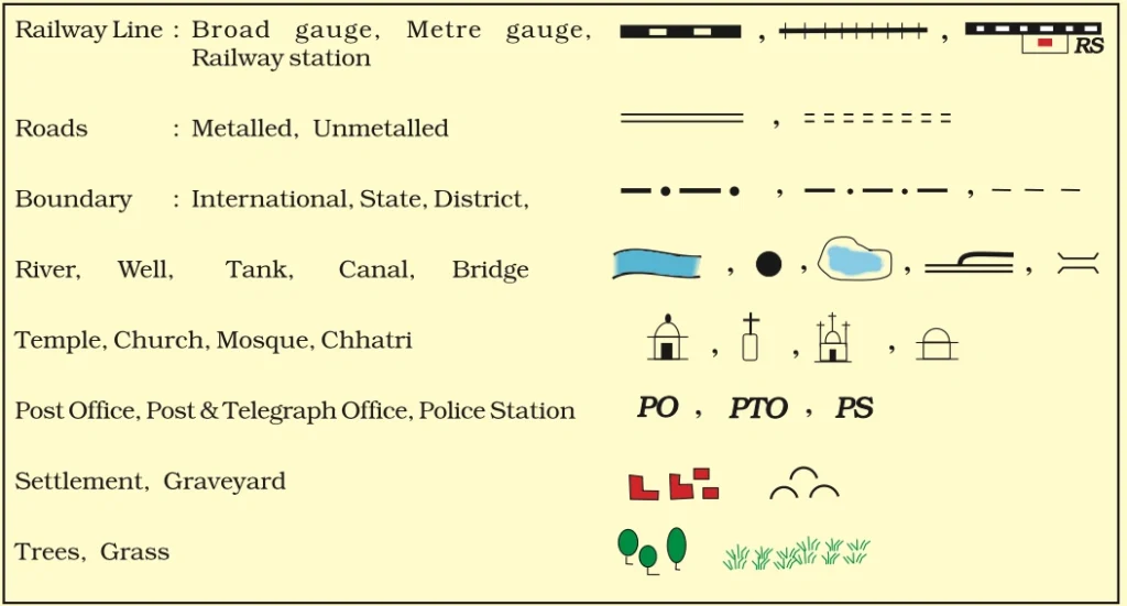
Use of color
Various colours are used to indicate a specific place. For example, generally blue is used for showing water bodies, brown for mountains, yellow for a plateau, and green is used for plains.
Sketch
A sketch is a drawing mainly based on memory and spot observation and not to scale. Sometimes a rough drawing is required of an area to tell where a particular place is located with respect to other places. Such a rough drawing is drawn without scale and is called a sketch map.
Plan
A plan is a drawing of a small area on a large scale. there are certain things which we may sometimes want to know for example the length and breadth of a room, which can’t be shown on a map. At that time, we can refer to drawings drawn to scale called a plan.
Question Based On Map Class 6 Notes
-
What is a map?
A map is a representation or a drawing of the earth’s surface or a part of it drawn on a flat surface according to a scale.
-
What is an atlas?
An atlas is a collection of many maps combined together.
-
Name three types of maps and their purposes.
• Physical maps: Show natural features of the earth such as mountains, plateaus, plains, rivers, and oceans.
• Political maps: Show cities, towns, villages, and different countries and states with their boundaries.
• Thematic maps: Focus on specific information such as road maps, rainfall maps, and maps showing the distribution of forests and industries. -
Explain the difference between a small scale map and a large scale map.
A small scale map shows a large area with less detail (e.g., 5 cm on the map represents 500 km on the ground). A large scale map shows a small area with more detail (e.g., 5 cm on the map represents 500 m on the ground).
-
What is a compass and how is it used?
A compass is an instrument used to find out the main directions. Its magnetic needle always points towards the north-south direction.
-
What is a sketch map?
A sketch map is a rough drawing based on memory and spot observation, not drawn to scale, used to show the location of a particular place in relation to other places.
You Can Download Class 6 Chapter 4 Pdf here
Note:- Our team doing a lot of hard work for you so please give your valuable feedback for this post Class 6 Geography Chapter 4 notes: Maps